The CaRPE Tool - American Farmland Trust

We’ve detected that you are using an outdated browser.

Please use a new browser like Chrome, Firefox, Safari or Microsoft Edge to improve your experience.

We’ve detected that you are using an outdated browser.

CaRPE Tool™

The Carbon Reduction Potential Evaluation Tool

CaRPE Tool™

CaRPE Tool lets users quickly visualize and quantify net GHG emission reductions.

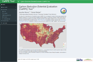
The Carbon Reduction Potential Evaluation Tool, or CaRPE Tool™, is a web-based interactive tool that allows users to quickly visualize and quantify greenhouse gas, or GHG, emission reductions resulting from the implementation of a suite of cropland and grazing land conservation management practices. 

CaRPE tool expands the utility of the data reported by COMET-Planner by layering cropland and grazing land acres data from the 2017 Census of Agriculture

The tool provides a mechanism to quickly compare practices, their estimated costs, and where the greatest GHG impact can be achieved across county, state, regional, and national scales. The tool’s data and maps help policymakers, conservation and agriculture professionals, and other influencers optimize efforts for cost-effective climate benefits from climate-smart practice adoption in targeted areas and systems.

Recent CaRPE updates allow users to:

  • View data by Farm Resource Region (in addition to counties and states)
  • See and map the weighted emission reduction coefficient for each scenario
  • Choose among four Conservation Practice Classes
  • More easily use the slider bars when developing scenarios
  • Specify their state’s estimated costs of implementation or use the national averages
  • Automatically see data aggregated by region and/or state
  • Consult the updated user guide on the CaRPE website

More Information about CaRPE Tool™

What can you do with CaRPE Tool™?
CaRPE Tool helps states seize carbon in agricultural lands. (Photo by Rebecca Drobis for AFT)

Map current acres and percent of cover crops and conservation tillage at county scale.

Estimate (and map) GHG reduction potential from current adoption levels.

Run scenarios for future GHG benefits from additional acres implementing practices.

Estimate implementation cost using national average EQIP rates or user-defined costs.

Generate maps and tabular data summarized for each scenario and scaled to county, state, regional, Farm Resource Region, or national levels.

Which crop and grazing land practices are available?
  • Six cropland management practices (and their NRCS Conservation Practice Standard codes):
    • cover crop (CPS 340)
    • residue and tillage management (CPS 329 and 345)
    • organic nitrogen application (CPS 590)
    • conservation crop rotation (CPS 328)
    • mulching (CPS 484)
    • stripcropping (CPS 585).
  • Five cropland conversion practices:
    • alley/multi-story cropping (CPS 311)
    • hedgerow planting (CPS 422)
    • tree/shrub establishment (CPS 612)
    • cropland to herbaceous cover (327)
    • forage and biomass planting (CPS 512)
  • Four grazing land management practices:
    • silvopasture (CPS 381)
    • prescribed grazing (CPS 528)
    • range planting (CPS 550)
    • organic nitrogen application (CPS 590)
  • Three grazing land conversion practices:
    • alley cropping (CPS 311)
    • hedgerow planting (CPS 422)
    • tree/shrub establishment (CPS 612)


Who is the tool designed for?
  • State policymakers, Soil and Water Conservation District planners, state and federal conservation agencies, NGOs, and other conservationists interested in optimizing climate benefits through climate-smart practices.

CaRPE Tool™ was developed by Dr. Jennifer Moore, AFT’s founding Climate Initiative director, as part of the AFT Climate Initiative, in collaboration with Dr. Daniel Manter, USDA-ARS soil scientist. It was funded in part by The Nature Conservancy, The Ida and Robert Gordon Family Foundation, and American Farmland Trust. CaRPE Tool is a trademark of American Farmland Trust.